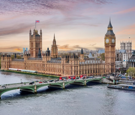
The worldwide timekeeping convention, known as Universal Time Coordinated (UTC), is often still colloquially referred to by its historical name, Greenwich Mean Time. But how did Greenwich, a borough in southeast London, become the reference point for timekeeping all around the world? To answer that, we have to go back to the 17th century, during Europe’s age of exploration.
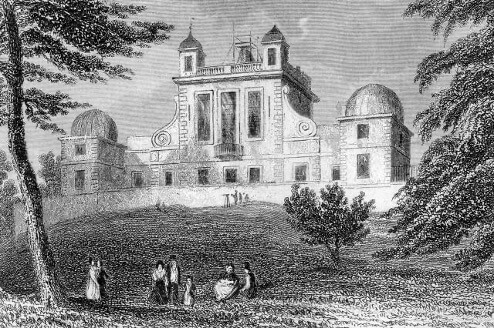
In 1674, King Charles II of England assembled a Royal Commission to study the possibility of creating a more precise measure of longitude in order to improve ship navigation. The greater oceanic distances being traveled by trade ships meant that any inaccuracies were magnified, causing shipwrecks and other maritime disasters; an improved reference for longitude would enable better course-plotting. The commission concluded that accurately determining star positions (as reference points) would be an essential part of the calculation, and recommended establishing an astronomical observatory. In response, Charles II appointed astronomer John Flamsteed as Britain’s first Astronomer Royal in 1675. Meanwhile, Royal Commission architect and astronomer Christopher Wren chose the ruins of Greenwich Castle as the site for the observatory. This was due to its location on high ground in a royal park, as well as the presence of the castle’s foundation, which could be repurposed for the observatory. Construction was completed in about a year, and Flamsteed began his first observations in 1676.
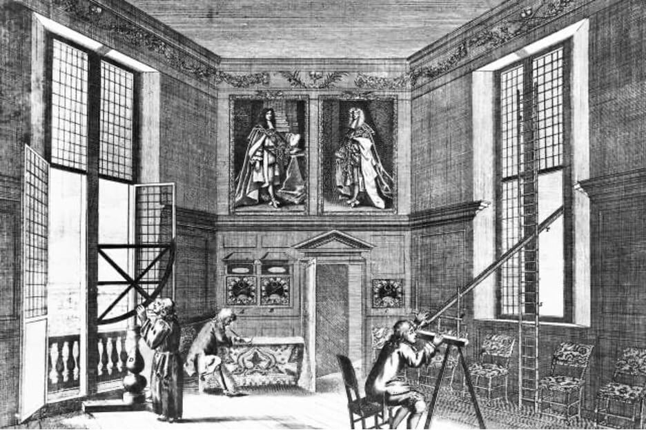
Flamsteed charted stars from Greenwich Observatory until his death in 1719. The catalog of nearly 3,000 stars he observed was published posthumously, first as the three-volume Historia Coelestis Britannica, and then the Atlas Coelestis, the largest and most accurate star atlas at the time. Flamsteed’s work was expanded on by Astronomer Royal Nevil Maskelyne, who published Nautical Almanac and Astronomical Ephemeris in 1766. These works contained the astronomical data needed to calculate longitude, with the help of celestial navigation tools such as the sextant and chronometer.
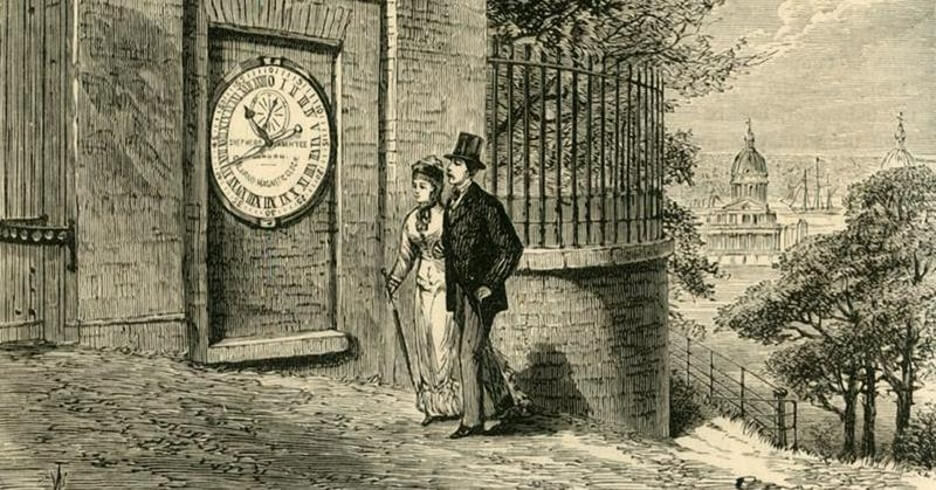
Using the sextant, which measures the angular distance between objects (such as the horizon and the sun), scientists could accurately observe the highest point of the sun: noon. The chronometer, a mechanical timepiece, was then set to precisely show the time at the Greenwich Observatory right at that moment. The difference between the time at Greenwich on the chronometer and local noon was translated to longitude: An hour of time difference was equal to 15 degrees of longitude (since the Earth rotates 360 degrees in 24 hours, or 15 degrees per hour). The lines of longitude were designated as east or west depending on whether the time at Greenwich was earlier or later than local time, respectively. This was the origin of Greenwich as a reference for timekeeping — at least, for British navigators.
Unlike latitude, for which the equator is Earth’s natural midpoint, the pole-to-pole vertical meridians have no such natural reference point. As a result, the location of 0 degrees longitude — known as the prime meridian — is arbitrary, and before a universal standard was established, many countries considered the longitudinal line running through their most significant port city as the prime meridian. France set the longitude at Paris as the prime meridian; in Spain, it was at Cádiz; in Italy, it was at Naples. In the 19th century, there were no fewer than 11 different prime meridians chosen by each of the world’s biggest shipping nations. Since time and longitude are so integral to each other, this also meant that there was no standardized timekeeping between nations.
The lack of an international time standard wasn’t impactful in the slow-moving era of seafaring, but the development of fast-moving transcontinental railroads in the mid-19th century changed that. Transcontinental train travel meant that a train would be crossing several different irregular time standards in relatively short order, especially in Europe, which in turn meant that a crew would have to make specific time changes with each national border crossing. The longer the distance of the trip, the more irregular time changes would need to be made, increasing the chance for scheduling errors and accidents. A solution was critical.
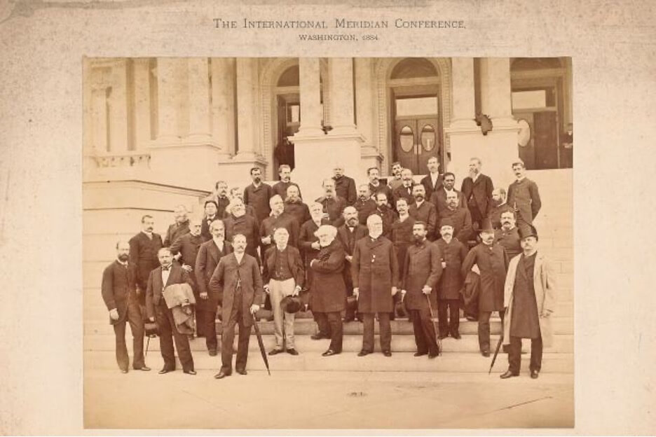
In 1884, U.S. President Chester A. Arthur convened the International Meridian Conference. Delegates from 21 nations met in Washington, D.C., to determine a globally recognized location for the prime meridian — and with it, a worldwide standard for time zones. Delegates from France argued that the meridian should not be located in either Europe or the U.S., so that it would have “a character of neutrality.” But support for the meridian to be located in Greenwich, England, was overwhelming, because a vast majority of the world’s shipping was already dependent on nautical maps that used Greenwich as 0 degrees longitude. The vote for Greenwich was nearly unanimous; only San Domingo voted against, with France abstaining.
A time zone standard was set with a one-hour time change every 15 degrees of longitude, with Greenwich Mean Time as the reference point. The time zones called for every 15 degrees east of the prime meridian to be an hour earlier than the time at Greenwich, and every 15 degrees west of the prime meridian to be an hour later. However, though the decision was made, it wasn’t actually binding. It took more than 20 years for Greece, Holland, Portugal, Russia, and Turkey to implement the decision on the location of the prime meridian and corresponding global time zone standard. France, proud of its own astronomical heritage, continued to use the Paris Observatory as the prime meridian, and did not adjust its time relative to Greenwich Mean Time until 1911.
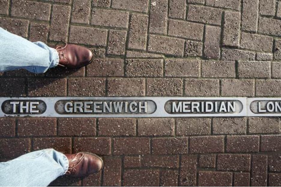
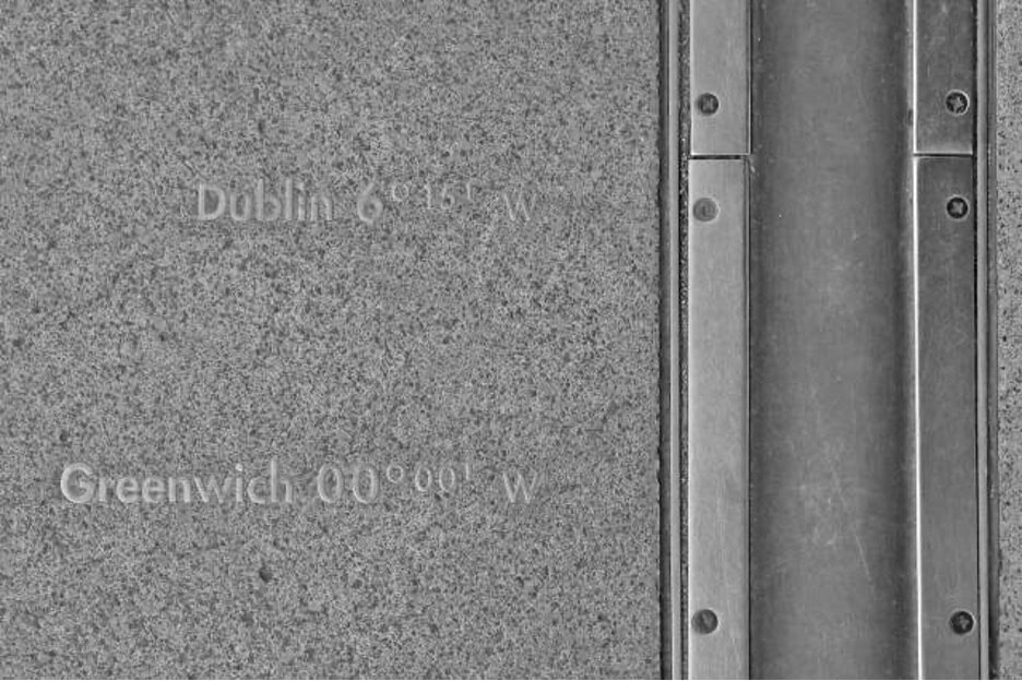
In 1972, Universal Time Coordinated (UTC) replaced Greenwich Mean Time (GMT) as the global standard for timekeeping. The reference point for UTC remains 0 degrees longitude, but thanks to technological advances such as GPS, a more precise location for 0 degrees longitude was determined and agreed upon in 1984. The current prime meridian is known as the International Reference Meridian. It’s located only about 334 feet east of the previous prime meridian — still in Greenwich, England.
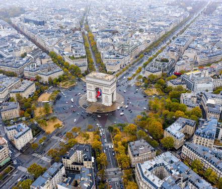
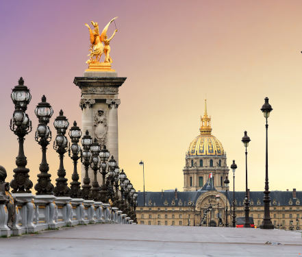
See the classic sights of Paris with this collection of Private Tours and other experiences. Great for New Travelers.
Some parts of France can’t be put into a 2 or 3-hour tour and some just take a while to get to. Venture out of Paris on an exciting Day Trip.
Experience some of the most significant works of art in Paris on a Private Art Tour. Learn about the story’s of the painters behind the works and ask questions along the way.
Taste the latest Paris Food experiences with our personal and tasty private food tours. Learn to make authentic Parisian meals, taste chocolate assortments, or…
From perfume to WW2, our private history tours are a way to see Paris in a different light.
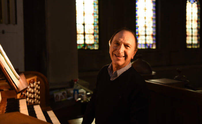
Experience immersive music tours in Paris. Sit and listen up close to an award-winning Master Pipe Organist or learn about the history of Jazz in Paris on a private tour!
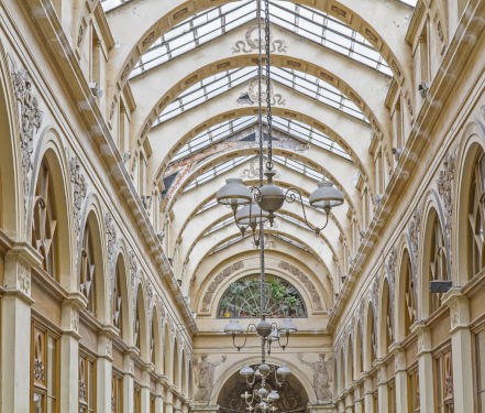
Looking for something particular? We’ll help you find it in Paris. Our private shopping tours include Antiques, Wardrobe, and more!
The Château de Fontainebleau, just 35 miles southeast of central Paris, can proudly claim to have been a sovereign residence for eight centuries. Capétiens, Valois, Bourbons, Bonaparte and Orléans, all members of French ruling dynasties, have lived within these walls. The chateau dates back to 1137—and centuries of royals have expanded this former royal hunting lodge to a more than 1,500-room estate. Most of what you’ll see dates back to the 16th century, a combination of Italian Renaissance art and French design, these rooms are some of the most intricate and breathtaking in France. If times allows, you can enjoy lunch in this charming area.
Tour Length: 5 – 6 hours


Comment (0)