
By Anne Swardson
There is something extraordinary about viewing a city from 30 feet above the ground. You are at once removed from the daily struggles on the street and yet eyeball-to-eyeball with residents of second-and-third story apartments.
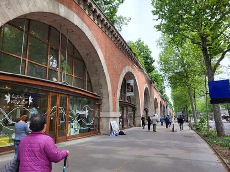
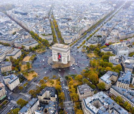
I was reminded of this during a recent walk on the Promenade Plantée, said to be the world’s first elevated park walkway. It’s often mentioned in tandem with its younger cousin, New York’s High Line, which runs along the Hudson River side of Manhattan. Both are on previously abandoned rail lines, making use of what once was decayed.
Paris’s promenade even uses the spaces between the viaduct’s archway for shops and restaurants, at least at its beginnings near the place de la Bastille. The promenade later dives below ground level, but we’ll get to that later.
The park section opened in 1998 and just gets lusher and lusher with time. The same is true of the High Line, opened in 2009.
Urbanist Ray Gaskil writes, in an article entitled “Prospect parks: walking the Promenade Planteé and the High Line,” that the “creative leap of faith in both projects is that the design of the path, its plantings, and edges can lead to a heightened experience of the strangeness and pleasure of walking thirty-feet up through a city.”
But the two paths, at least to me, reveal different vistas. On the High Line, the views are mostly out—to the river and the buildings on the other side, or down the cross streets. The photos in Annik LaFarge’s blog “Livin’ the High Line” show some of those wonderful perspectives.
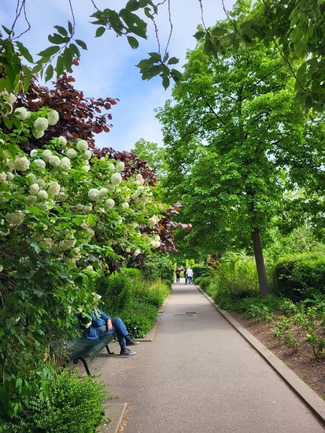
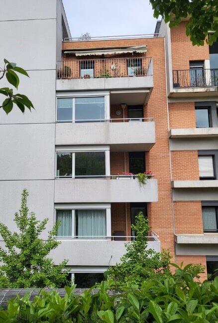
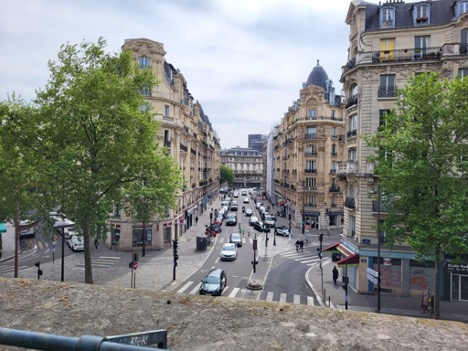
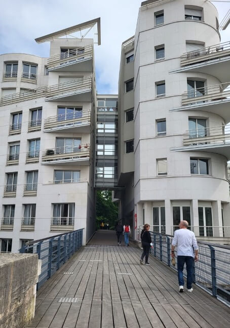
That’s not the same as looking into someone’s bedroom window or apartment balcony, as one does on the Promenade Plantée. In some places you can’t even tell you’re above the street. In others, you are keenly aware of it, both by the view of the residences and by the sight of eastern Paris from any of several footbridges.
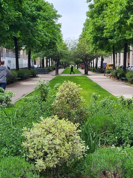
During my walk, I saw human activity on both levels. In front of me, several groups of Scouts were engaged in some kind of scavenger hunt, and many people on this sunny day planted themselves on park benches to read. Below, cars fought for parking places.
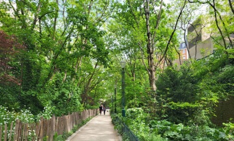
There were so many lovely scenes during my two-hour walk: Clusters of irises, for instance, which I rarely see in Europe. People in the nearby buildings must enjoy them too.

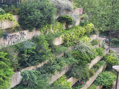
And a terraced garden. Since this was eastern Paris, it also included graffiti.
I walked through—or was it between?—a building that seemingly made way for the path. I tried to figure out which had come first and figured it had to be the promenade.
About halfway through the three-mile (4.5 km) walk, due south of Place de la Nation, the path dropped to ground level for a short time.
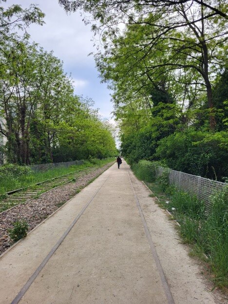
And then unexpectedly, it became the low road, otherwise known as the Coulée Verte. Same rail line, which ran from Bastille to the suburb of Varenne–Saint-Maur until 1969.

The beauty and greenery remained, but the magic of looking over the city and the intimacy of sharing space with residents and office workers was gone.
Not long after that—I wasn’t entirely sure I was taking quite the right path—I found myself on a real, though still unused, rail line, in the company of only a few picnickers and walkers.
From here it was a short walk to exit the line over a bridge and to figure out where the optimal Métro or tramway station might be in this corner of the city, not far from the Porte de Vincennes.
My next goal: Do the same walk in reverse. Another perspective change.
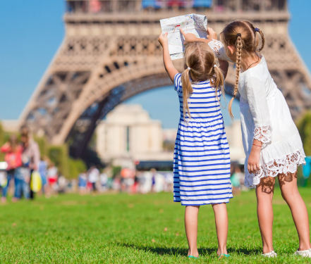
See the classic sights of Paris with this collection of Private Tours and other experiences. Great for New Travelers.
Some parts of France can’t be put into a 2 or 3-hour tour and some just take a while to get to. Venture out of Paris on an exciting Day Trip.
Experience some of the most significant works of art in Paris on a Private Art Tour. Learn about the story’s of the painters behind the works and ask questions along the way.
Taste the latest Paris Food experiences with our personal and tasty private food tours. Learn to make authentic Parisian meals, taste chocolate assortments, or…
From perfume to WW2, our private history tours are a way to see Paris in a different light.
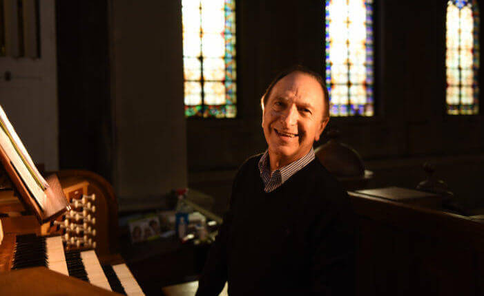
Experience immersive music tours in Paris. Sit and listen up close to an award-winning Master Pipe Organist or learn about the history of Jazz in Paris on a private tour!
Looking for something particular? We’ll help you find it in Paris. Our private shopping tours include Antiques, Wardrobe, and more!
The Château de Fontainebleau, just 35 miles southeast of central Paris, can proudly claim to have been a sovereign residence for eight centuries. Capétiens, Valois, Bourbons, Bonaparte and Orléans, all members of French ruling dynasties, have lived within these walls. The chateau dates back to 1137—and centuries of royals have expanded this former royal hunting lodge to a more than 1,500-room estate. Most of what you’ll see dates back to the 16th century, a combination of Italian Renaissance art and French design, these rooms are some of the most intricate and breathtaking in France. If times allows, you can enjoy lunch in this charming area.
Tour Length: 5 – 6 hours


Comment (0)